The best place to access the LAL maps is on our ArcGIS Hub: https://university-of-the-south-lalsewanee.hub.arcgis.com/. From there you can access downloadable PDFs of the hiking map, equestrian map, and access an interactive online version of the hiking map.
The Landscape Analysis Lab regularly updates the geo-enabled pdfs on the Mobile Maps and Hub pages for use by the Sewanee community. You are welcome to download these maps for use while on the Domain.
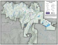
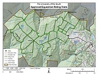
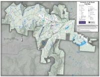
The thumbnail maps below can be clicked on for links for page-sized geopdf maps. These were created by the Landscape Analysis Lab for use on the Domain.
For rules and regulations regarding recreation on the Domain, refer to the Office of Environmental Stewardship and Sustainability (OESS) here: environmental-stewardship-sustainability/the-domain/recreation/
Hiking on the Domain
 Please review the full trail use rules here
Click here to download a PDF copy of the Domain Hiking Map
Click here to go to the online, interactive copy of the Domain Hiking Map
 Please review the rules about horseback riding on the Domain here.
Click here for Riding Trails Map
Mountain Biking Trails
Campsites
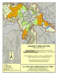
Deer Hunt Map (for Hunters)