Courses, Workshops, and Individualized Training
The main role of the LAL is to provide training in geographic information science to undergraduate students. The core GIScience curriculum at the LAL includes two courses taught through the Environmental Studies program: Fundamentals of GIS (ENST 217) and Advanced Applications of GIS (ENST 317). In addition to these courses, students are encouraged to incorporate GIS into independent research projects and to pursue additional training opportunities through modules and online courses.
The LAL offers individual and group training opportunities for faculty, staff, and students. GIS is a tool used in many disciplines acrss the natural and social sciences and the LAL works with faculty to incorporate GIS training into their courses and projects. For our partner organizations and other groups in the region, the LAL periodically offers training workshops focused on a specific application of GIS or a specific software package.
Research Support
The LAL serves as a resource for faculty and students from all departments and programs at the University of the South. LAL staff are available to assist faculty and students with all their GIS and mapping needs, including project planning, map production, and geospatial data development. The LAL is also actively involved in a number of projects led by faculty and student researchers, provides general support in the areas of database design, data management, and environmental data analysis. Read more about the past and present research projects supported by the LAL.
Geospatial Data Resources
The Landscape Analysis Lab works with faculty and student researchers at the University of the South to develop original geospatial datasets. The LAL also maintains current versions of datasets developed by federal, state, and local agencies and can assist researchers in the use and analyses of these datasets. The original geospatial datasets developed by the LAL primarily cover two areas: the University’ 13,000 acre landholdings known as the Domain; and the Cumberland Plateau region.
Geospatial datasets describing subjects such as current and historical land use, ecological habitats, topography, hydrography, and natural resource management are available to researchers through the online Digital Domain Geospatial Database. For more specific needs or questions about the datasets, please contact the LAL Manager.
Domain maps for recreation are available at the LAL's Mobile Maps page. Map resources for Domain management are available below.
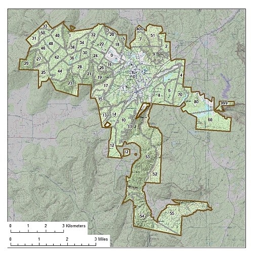
Map Resources
Domain Compartments