For over a decade, the Landscape Analysis Lab has used geospatial technologies to study and quantify environmental change in the Southeast. Central to the mission of the LAL is interdisciplinary research that brings together faculty and undergraduate students from across the natural and social sciences. We will continue to add new and finished research projects to this list. For more information about each project, click on the appropriate link below.
- The Roberson Project on Slavery, Race, and Reconciliation
The Roberson Project has had multiple collaborations with the LAL to help investigate and understand the university's legacy with slavery. One of those projects traces the slave histories of the university's founding Trustees here in a storymap titled "Within the Pale of the Plantation States: Slavery and the Governance of the University of the South in 1860". A second project identifies many of the problematic placenames on Sewanee's Domain, and explains why those names are troublesome on the "Sewanee Place Name Journal". - Mapping Trench Town in West Kingston, Jamaica
Working with Dixon Myers, of the Civic Engagement Office, the LAL created an interactive walking tour of Trench Town, Jamaica and an interactive map for the Trench Town Culture Yard. Trench Town is a public housing scheme built in the 1940’s in Kingston. The over seven-block area became home to artists and musicians that changed the world, most notably as the birth place of Reggae and Bob Marley. - Historic Houses Exhibit
To support an exhibit assembled by Mary O'Neill and shown in the University Archives, the LAL created a driving tour and online interactive map of notable historic homes in Sewanee, with links to information, pictures, and stories of those homes. - Sewanee Forest History Project
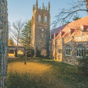
Over it's 150 year history, the lands owned by the University has grown to 13,000 acres. The diverse land use history and thorough documentation of past activities is a resource for students researching long-term environmental change. - Springs of the Cumberland Plateau
Collaborative research on the oral histories, chemistry, and hydrology of springs on the Cumberland Plateau. - Mapping Vernal Pool Wetlands on the Cumberland Plateau
On the sandstone-capped Cumberland Plateau, a unique type of forest pond wetland exists that supports a remarkably diverse ecological community. Students at the LAL are studying the distribution and abundance of these unique wetlands.
- Preparing for the Arrival of the Hemlock Woolly Adelgid in TN State Parks
The Hemlock Woolly Adelgid is making its way west towards the Cumberland Plateau. Faculty and students from the LAL are working with regional state parks to develop a management and treatment plan. - Supporting Regional Conservation: The South Cumberland Conservation Action Plan
The LAL is working with the Land Trust for TN and many other organizations to develop resources for conservation planning in the Cumberland Plateau region. - Mapping Forest Change on the Cumberland Plateau: 1981-2001
The Cumberland Plateau in Tennessee contains some of the largest remaining tracts of privately owned, contiguous temperate deciduous forest in North America. Between 1981 and 2001, this area experienced substantial changes in forest cover primarily due to the expansion of timber industry lands. This change was quantified through interpretation of aerial imagery and mapping of land cover types. - Floristic Community Assessment on the Domain
The 13,000 acre Domain of the University of the South has over 1,000 plant species. Nathan Bourne and Katherine Qualls are studying the relationship between different plant communities and the environmental conditions that affect them.