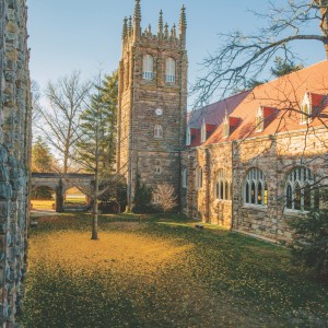
This trail guide is best when used alongside the official Sewanee Trail Map. You can find printed trail maps at the Sewanee Visitors Center.
A Quick Start Guide for Hiking in Sewanee
Downloadable pdf
Trail Blazing and Signage: The Perimeter Trail is marked with blue blazes while secondary trails are marked with white blazes. At each trail intersection, signage indicates the distance to the next trail junction, difficulty of the next trail section, prohibited uses, and cautions. Each trail junction sign also contains a unique number. In the event of an emergency, call 911 and give the responders the number of the closest trail junction to help them locate you.
Below, we highlight a selection of hikes that offer a great introduction to the Domain. If you’re feeling ambitious and want to hike all 20 miles of the Perimeter Trail in one day, we recommend parking at the Sewanee Visitors Center in Sewanee Village and following the Perimeter Trail as marked from there. This will put you right back at the village when you finish and in perfect position for a treat at one of our local establishments.
A note on the Mountain Goat Trail: This section of the Perimeter Trail at the Sewanee Village runs along a regional rails-to-trails project called the Mountain Goat Trail, which extends toward the nearby town of Monteagle and beyond. Folks of all ages and skill levels can enjoy walking, running, and biking for many miles heading
east toward Monteagle. Stay tuned as the future extension of the Mountain Goat Trail is planned to be completed toward Cowan, however, that section will involve a big descent and may not be suitable for all ages.
Village Connector to Point Disappointment
Distance: 2.2 miles roundtrip
(approx. 1.25 hours)
Parking area: Sewanee Visitors Center in Sewanee Village
From the Sewanee Visitors Center, walk south to the intersection of Baker’s Lane and Ball Park Road. (Yes, it is OK to walk directly there through the playground of the Sewanee Community Center). Here you’ll find the start of the Village Connector Trail. Follow this trail to the Caldwell Rim Trailhead and bear left onto Potter’s Ridge Trail. After about .3 miles, the Point Disappointment Trail will be on the left. Follow that trail to see not one, but two beautiful lookout points. Point Disappointment is anything but disappointing, affording views of almost the entirety of Lost Cove.
Lake Cheston Loop
Distance: .75 miles
(approx. 20 minutes)
Parking area: Lake Cheston
A simple and beautiful loop around Lake Cheston. Perfect for little ones. Bring your swimsuit and jump in the lake.
Piney Point
Distance: 2.0 miles roundtrip
(approx. 1.5 hours to allow for some time at the view!)
Parking area: University Gates
From the University Gates, follow the Perimeter Trail toward Shakerag Hollow. At the first wooden bridge, bear right and follow signs for the Piney Point Trail. Follow this trail all the way to Piney Point. There is a steep drop-off at the end, so be careful with your bikes, dogs, and little ones. This trail features a great view from the point looking over Shakerag Hollow and into Roark’s Cove.
Tennessee Williams Trail
Distance: 0.8 miles roundtrip
(approx. 45 minutes)
Parking area: Memorial Cross
Park at the Memorial Cross to enjoy a wonderful view of the valley looking southwest toward Hawkins Cove. Then head out on the Tennessee Williams Trail for a pleasant out-and-back stroll. This trail is parallel to Tennessee Avenue.
Wiggins Creek Trail
Distance: 1.2 miles roundtrip
(approx. 35 minutes)
Parking area: Lake Cheston
From the lower parking lot, cross the dam of the lake and look for the Wiggins Creek Trail to the left, marked with white markers. Follow this trail past the Parallel Trail until you intersect with the Perimeter Trail. From here, you can choose to add 1.2 miles total (35 minutes total) in either direction by heading toward Morgan’s Steep (left) or Otey View (right).
Lake Dimmick via Mountain Goat
Distance: 6.2 miles roundtrip
(approx. 3.5 hours)
Parking area: Sewanee Visitors Center in Sewanee Village
From the Visitors Center, follow the Mountain Goat Trail .6 miles east toward Monteagle. Keep an eye out for the 4x4 post on your right indicating the start of the Dimmick Trail. Follow the trail 2.5 miles to Lake Dimmick. This trail crosses two roads and is great for hiking and mountain biking.
Caldwell Rim Loop
Distance: 2.5 miles
(approx. 1.5 hours)
Parking area: Caldwell Rim Trailhead
We recommend doing the loop clockwise. You can also access this trail by parking at Sewanee Village and following the Ballpark Trail to Caldwell Rim (adds 1.2 miles/35 minutes total). This trail is great for hiking and mountain biking.
Forestry Cabin Loop
Distance: 5.3 miles
(approx. 3 hours)
Parking area: Lake Cheston
From Lake Cheston, head toward the water tower and follow the Water Tower Trail until it intersects the Perimeter Trail. Turn left on the Perimeter Trail, passing the short spur trail to KA Point (scenic!) and follow signs to the Forestry Cabin. Just after the cabin, continue along the Forestry Cabin road (not the Perimeter Trail) until you get to Gate 5 on Breakfield Road. Turn right onto Breakfield Road and proceed to Gate 14 on your left. Walk around Gate 14 and follow the fire lane for .4 miles until you hit the Parallel Trail. Turn left on the Parallel Trail and follow it to the Wiggins Creek Trail. Take a left onto the Wiggins Creek Trail and follow the white markers back to Lake Cheston.

Shakerag Hollow to Beckwith's Point Loop
Distance: 3.4 miles
(approx. 2 hours)
Parking area: University Gates
One of Sewanee’s most popular hikes. From the University Gates, follow the Perimeter Trail into Shakerag Hollow. After hiking through much of Shakerag Hollow, follow the spur trail toward Green’s View, which will lead up a set of steep stone stairs to an intersection with Beckwith’s Point Trail. Go left to follow Beckwith’s Point Trail back to the University Gates. Shakerag Hollow features beautiful wildflowers in springtime.
Please note: Mountain bikes are not permitted in Shakerag Hollow.
Memorial Cross to Morgan’s Steep
Distance: 2.2 miles round trip
(approx. 1.5 hours)
Parking area: Memorial Cross
From the Memorial Cross, face the valley and take a right to follow the Perimeter Trail. Stay on the Perimeter Trail, avoiding the Proctor’s Hall Trail, to descend the easy old roadbed. Continue following the Perimeter Trail blue blazes until you reach a large wooden bridge that has a terrific view of the cascading creek. You can choose to make this your final destination or cross the bridge and take a right to follow the faint trail toward Morgan’s Steep. To reach Morgan’s Steep, continue up the concrete steps. Retrace your route for this beautiful round-trip hike that allows for two views.
Bridal Veil Falls
Distance: 2.2 miles round trip
(approx. 1.5 hours)
Parking area: Lake Cheston
From Lake Cheston, follow the Cheston Trail and cross a small bridge before arriving at Clara’s Point Road. Go left on Clara’s Point Road for 100 feet and then turn right to rejoin the Cheston Trail. Continue on until you arrive at another small wooden bridge. Immediately after crossing this bridge, take a left to descend the plateau on the Bridal Veil Trail until you reach the falls. You can simply retrace your steps back to Lake Cheston, or you can choose to make a loop out of this hike as shown on the map.
Please note: Mountain bikes are not permitted on this trail.